A lighthouse keeper’s tide chart was not meant to be mysterious.
It was a working document, made for men who needed to know when rocks would show, when shoals would cover, and when a rescue boat could leave without breaking itself on the ledges.
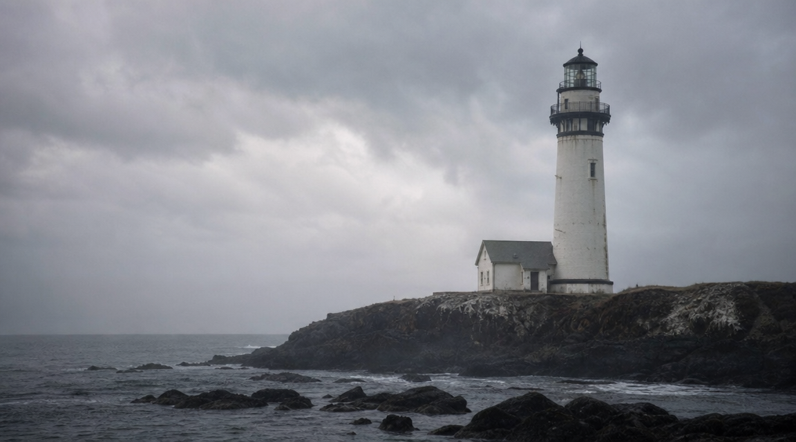
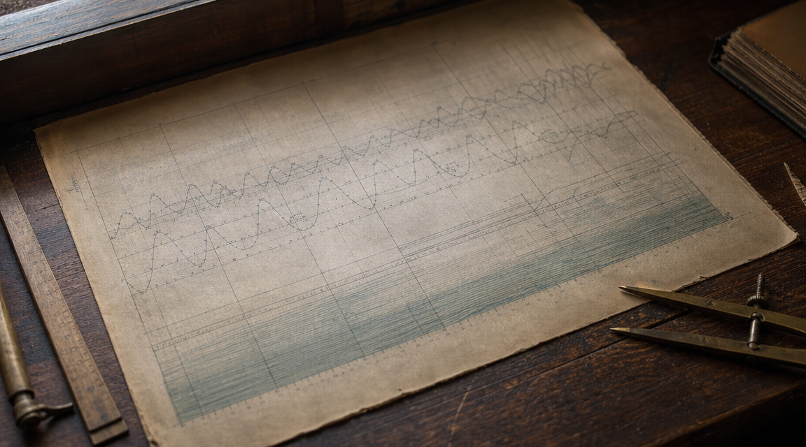
The chart dated 1894 looks modest enough at first glance. It shows a blunt piece of coast, a lighthouse station, soundings in small careful figures, and a run of tide marks written by a hand trained to be useful rather than artistic.
Then the eye finds the problem: a narrow inlet drawn where the coast is supposed to be unbroken, with annotations suggesting a boat crossed into it during a rescue no official map has ever been able to place.
The Chart in the Archive
The tide chart is usually described as a station copy, not a printed government chart. That distinction matters.
Printed coastal surveys carried authority. A keeper’s working sheet carried weather, corrections, scrawled warnings, and whatever local knowledge kept lamps lit and boats intact.
This one appears to have been compiled or heavily annotated in 1894, during a period when many coastal stations kept practical notes alongside formal logs. Its paper, ink, and style all fit the era well enough to avoid easy dismissal as a modern novelty.
Nothing on the sheet announces a secret. The oddity is hidden among ordinary marks: tide heights, times, small arrows for current, and a penciled line cutting inland from a rocky reach where standard charts show only a hard shore.
It is that quietness that gives the document its force.
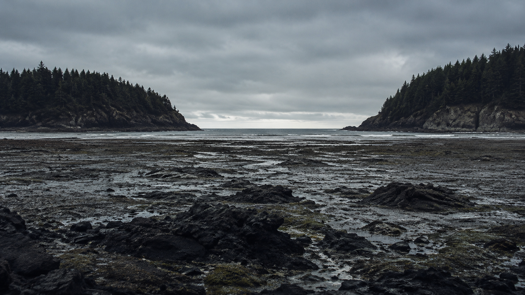
A Coast That Should Not Open
The disputed inlet is not grand. It is drawn as a slit between two shoulders of rock, just wide enough to admit a small boat on a rising tide.
On modern maps, there is no such cut. On older survey sheets, there is no such cut. Local harbor guides from the late nineteenth and early twentieth centuries describe reefs, exposed shelves, and dangerous tide races, but not a navigable opening at that place.
This is where the story becomes uncomfortable for historians rather than spectacular for ghost hunters.
Coastlines move. Storms remove shingle, sandbars migrate, cliffs collapse, and channels that matter to one generation may be gone by the next. A missing inlet is not impossible.
But this coast was not a soft delta or marsh edge. It was described as rockbound, surveyed more than once, and dangerous precisely because it offered so few breaks.
A channel wide enough for a rescue boat should have left some trace in local language, wreck reports, pilot notes, or later memory.
The Tide Marks That Refuse to Fit
The inlet would be easier to explain if the tide readings around it behaved normally.
They do not.
The keeper’s marks show water reaching and leaving the alleged cut at times that do not match the nearest known coves or exposed shelves. Several entries appear to place the flood earlier than expected, as though the water were entering a separate pocket before it rose along the visible shore.
That could be a mistake. Tide tables were copied, corrected, and sometimes misunderstood, especially when local effects complicated the official predictions.
Yet the notations are consistent enough to look observed rather than invented. The same small delay appears in one place. The same early lift appears in another. The handwriting changes pressure, not method.
A random error usually wanders. This one seems to repeat.
That repetition is why the chart has remained interesting after more dramatic explanations fall away.
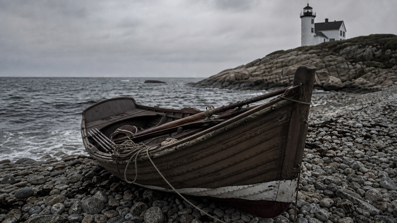
The Rescue Note
Near the penciled inlet is a short annotation, partly faded, that has drawn the most attention.
It appears to refer to the station boat going inside or into the inner water after a distress sighting. The wording is not clean enough to quote with confidence, and cautious readers should resist the temptation to make it say more than it does.
Still, the implication is difficult to avoid. A rescue boat was directed toward the marked opening, or was later remembered as having used it.
There is no matching inlet in the official coastal record. There is no neatly corresponding wreck report that explains why a crew would have gone there. If the note is read plainly, the keeper was not sketching a fantasy channel for amusement. He was recording a route connected to emergency work.
That does not prove the inlet existed.
It does make a simple copying mistake harder to accept.
What a Keeper Would Have Known
Lighthouse keepers were not armchair mapmakers. Their authority came from repetition.
They watched the same rocks disappear and return. They measured weather by habit. They learned which patches of white water meant wind, which meant reef, and which meant a tide running where a stranger would see only broken sea.
A keeper could know a temporary passage that did not deserve a printed name. He might mark a usable cut that opened only under a narrow set of tide and swell conditions.
That explanation is the strongest ordinary one. The chart may preserve local operational knowledge too fine or too dangerous for a general map.
But even then, the absence is strange. A passage useful enough for a rescue note was also hazardous enough to warn about. Stations tended to share dangerous knowledge because lives depended on it.
If the inlet was real, it was either remarkably short-lived or strangely private.
The Map Error Theory
Another possibility is that the chart was copied from a damaged or misread source.
A stain can become a channel. A fold can become a coastline. A keeper adding tide notes to an old base map might accidentally dignify a paper flaw with practical markings.
The problem is the surrounding annotations. The tide marks cluster around the disputed feature as if the feature mattered. They are not scattered across the sheet at random, and the rescue note sits too near the penciled cut to ignore.
There is also the question of scale. The inlet line is positioned with care, not scratched vaguely into an empty corner. It connects with the shore where a user would expect a channel mouth to be.
A map error remains possible.
It just has to be a map error that attracted correct-looking tide observations and an operational note.
Could the Coast Have Changed?
Storm history offers another route through the puzzle.
The late nineteenth century produced severe coastal storms in many regions, some capable of rearranging bars, breaching shingle banks, and altering approaches overnight. An inlet could open during one season, serve briefly, then close before later surveyors recorded it.
If the disputed place included a rock cleft masked by beach stone or storm debris, a rare surge might have cleared it. A following winter might have sealed it again.
That explanation fits the temporary nature of the evidence. It also fits the keeper’s practical attention to tides.
But the same explanation weakens when applied to solid rock. A storm can clear loose material. It cannot usually carve a neat navigable inlet through resistant headland and leave no scar anyone later recognized.
Unless the chart does not show a true inlet at all, but a momentary route across flooded ledges that only looked like one to the man who needed to use it.
The Uncomfortable Middle Ground
The strongest reading of the 1894 tide chart is not that it proves a vanished harbor or a supernatural coast.
It is that it records an experience of the shoreline that does not align with the surviving record.
That difference matters. Archives often flatten difficult places into clean lines. Working documents preserve the messy version: the shortcut, the warning, the local name, the tide that arrives early in a pocket nobody official bothered to label.
The chart may be wrong. The keeper may have copied bad data. The inlet may be a visual error given too much weight by later readers.
But each ordinary answer leaves something behind: the repeated tide behavior, the careful placement, the rescue annotation, and the silence of every map that should have helped.
The case lives in that gap between paper authority and lived coast.
Why It Still Feels Unsettled
There is a particular unease in finding a route on an old chart that no longer has a place in the world.
A haunted house asks us to imagine a presence. A tide chart asks us to accept measurement. It is harder to dismiss because it speaks in practical marks, not claims.
The 1894 keeper was likely trying to solve ordinary problems: water depth, boat access, bad weather, a call for help. If he drew an inlet, he may have believed the inlet was there because, at least once, the sea behaved as if it was.
That is the most disturbing version of the story.
Not that the coast was magical. Not that a rescue boat vanished into another place. Only that a trained observer wrote down a navigable opening where the land now insists there was none.
The tide chart remains less a proof than a question in ink.
And the question is simple enough to last: where did the boat go, if the maps were right?
Reader Context
This Weird Witnessed story is an editorial reconstruction, written as eerie visual storytelling rather than a verified report. For more context, see How to Read Weird Witnessed Stories and How WeirdWitnessed Creates Reconstructed Horror Stories.